About
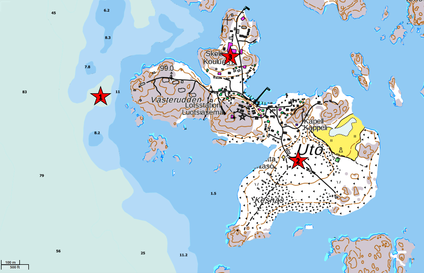
Locations of the measurement sites at Utö island (59.78°N,
21.37°E):
1) seawater intake, ADCP measurements, 2) automatic
weather station, 3) ICOS station (atmospheric CO2).
These pages contain real-time data measured at the Utö Atmospheric
and Marine Research Station located on Utö island at the outer edge
of the Finnish archipelago. The station is operated by the Finnish
Meteorological Institute (FMI) and the Finnish Environment Institute
(SYKE).
Find more information on FMI web pages:
http://en.ilmatieteenlaitos.fi/uto
The automatic weather station (AWS) data from Utö, as well as sea level data from the nearby tide gauge stations Hanko and Föglö, are freely available from the FMI open data interface.
The data provided in these pages are automatically updated and have not been manually quality checked. Thus, the data may contain errors and inaccuracies.
The timestamps of the data are given in Finnish local time. In winter this is EET = UTC+2h, in summer daylight saving time is used: EEST = UTC+3h. The daylight saving time is used from late March to late October, the exact dates for each year can be found e.g. here: https://www.timeanddate.com/time/zone/finland/helsinki.
This virtual access portal is part of the JERICO-RI Virtual Access services.
 This project has received funding from the European Commission’s Horizon 2020
Research and Innovation programme under grant agreements No 871153 and 951799.
Project coordinator: IFREMER, France. The information and views of this website
lie entirely with the authors. The European Commission is not responsible for
any use that may be made of the information it contains.
This project has received funding from the European Commission’s Horizon 2020
Research and Innovation programme under grant agreements No 871153 and 951799.
Project coordinator: IFREMER, France. The information and views of this website
lie entirely with the authors. The European Commission is not responsible for
any use that may be made of the information it contains.
This site uses Matomo Analytics for cookieless, privacy-friendly user analytics.